
Sundarban means “beautiful forest.” It may have been derived from the word Sundari or Sundri, the local name of the mangrove species Heritiera fomes. Alternatively, it has been proposed that the name is a corruption of Samudraban, Shomudrobôn (“Sea Forest”),There are several amazing places in Sundarbans, you must not miss. Among the places are Kotka Beach, Jamtola Beach, Karamjol, Hiron Point (Nilkomol), Dublar Char Island, Tin Kona Island, Kochikhali Forest, Mandarbaria.
The Sundarbans is a mangrove area in the delta formed by the confluence of the Ganges, the Brahmaputra and the Meghna Rivers in the Bay of Bengal. It spans from the Hooghly River in India’s state of West Bengal to the Baleswar River in Bangladesh.
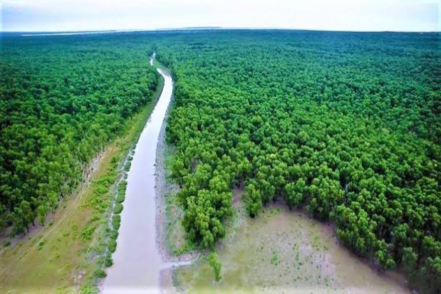
It comprises closed and open mangrove forests, agriculturally used land, mudflats and barren land, and is intersected by multiple tidal streams and channels.
Four protected areas in the Sundarbans are enlisted as UNESCO World Heritage Sites, viz. Sundarbans National Park, Sundarbans West, Sundarbans South and Sundarbans East Wildlife Sanctuaries. Despite these protections, the Indian Sundarbans were considered endangered in a 2020 assessment under the IUCN Red List of Ecosystems framework.
The Sundarbans mangrove forest covers an area of about 10,000 sq km (3,900 sq mi), of which forests in Bangladesh’s Khulna Division extend over 6,017 sq km (2,323 sq mi) and in West Bengal, they extend over 4,260 sq km (1,640 sq mi).
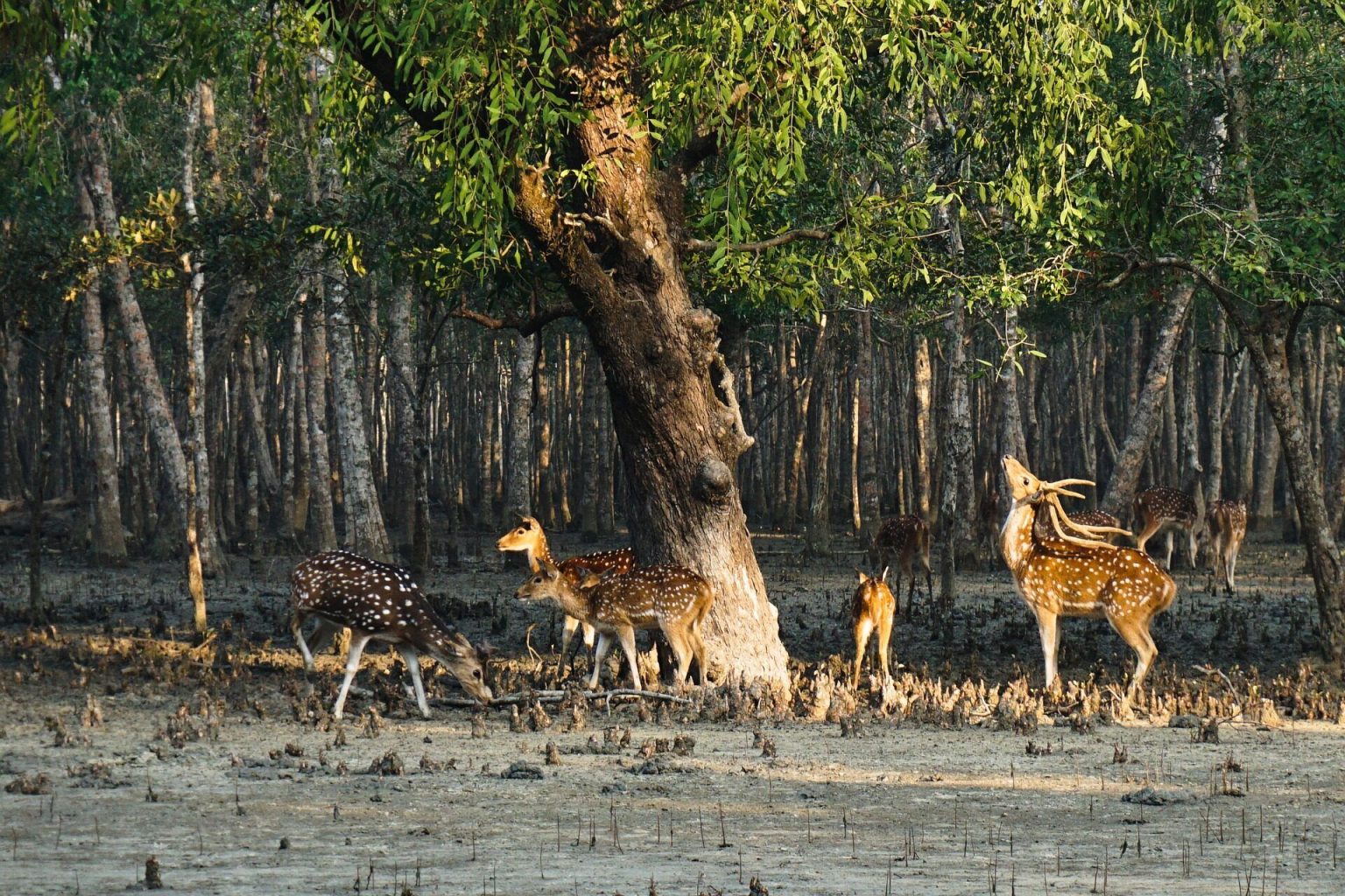
The most abundant tree species are sundari (Heritiera fomes) and gewa (Excoecaria agallocha). The forests provide habitat to 453 faunal wildlife, including 290 bird, 120 fish, 42 mammal, 35 reptile and eight amphibian species.
Despite a total ban on all killing or capture of wildlife other than fish and some invertebrates, it appears that there is a consistent pattern of depleted biodiversity or loss of species in the 20th century, and that the ecological quality of the forest is declining. In Bangladesh, a Forest Circle was created in 1993 to preserve the forest, and Chief Conservators of Forests have been posted since.
The Sundarbans freshwater swamp forests are a tropical moist broadleaf forest eco region of Bangladesh. It represents the brackish swamp forests that lie behind the Sundarbans Mangroves, where the salinity is more pronounced. The freshwater eco region is an area where the water is only slightly brackish and becomes quite fresh during the rainy season, when the freshwater plumes from the Ganges and the Brahmaputra rivers push the intruding salt water out and bring a deposit of silt. It covers 14,600 square kilometres (5,600 sq mi) of the vast Ganges-Brahmaputra Delta, extending from the northern part of Khulna District and finishing at the mouth of the Bay of Bengal with scattered portions extending into India’s West Bengal state. The Sundarbans freshwater swamp forests lie between the upland Lower Gangetic plains moist deciduous forests and the brackish-water Sundarbans mangroves bordering the Bay of Bengal.
The Sundarbans Mangroves eco region on the coast forms the seaward fringe of the delta and is the world’s largest mangrove ecosystem, with 20,400 square kilometres (7,900 sq mi) of an area covered. The dominant mangrove species Heritiera fomes is locally known as sundri or sundari. Mangrove forests are not home to a great variety of plants. They have a thick canopy, and the undergrowth is mostly seedlings of the mangrove trees.
Besides the sundari, other tree species in the forest include Avicennia, Xylocarpus mekongensis, Xylocarpus granatum, Sonneratia apetala, Bruguiera gymnorhiza, Ceriops decandra, Aegiceras corniculatum, Rhizophora mucronata, and Nypa fruticans palms. Twenty-six of the fifty broad mangrove species found in the world grow well in the Sundarbans. The commonly identifiable vegetation types in the dense Sundarbans mangrove forests are salt water mixed forest, mangrove scrub, brackish water mixed forest, littoral forest, wet forest and wet alluvial grass forests.